


Geodesy and Gravimetry
Einstein’s theory of General Relativity shows that space and time are closely connected. Even the frequency of an atomic clock changes with its location in Earth’s gravitational potential. To take this change into account, it is necessary to know both the local force of gravity and the vertical position of the clock.
NICT operates a number of observation facilities for geodesy.
Gravimetry
Gravimetry is the measurement of the strength of the gravitational field (gravitational acceleration), which is affected by the position of the moon and the sun similar to the tides of the ocean. Large earthquakes can also cause enough crustal deformation to be detected by gravimetry. At the Space-Time Standards laboratory, we continuously monitor the variations of this field with a gravimeter that has a relative uncertainty of 1 μGal, sufficient to observe variations as small as one part in 10⁹. We are working with other geodetic institutes to determine the overall, absolute value of gravitational acceleration.
But this alone is not sufficient for accurate clock frequency measurements. The force of gravity tells us only how much the gravitational potential changes with height over the ground. We need the potential U itself to obtain the relation between coordinate time interval Δt and the proper time interval Δτ obtained by a measurement, as represented by the equation
where c is the speed of light, and Δt is a coordinate time interval, such as one “tick” interval of an ideal atomic clock free from gravitational potential. Near the surface of the Earth a change of 1 cm in height is enough to change the progress of time by one part in 10¹⁸. Optical atomic clocks are already reaching this level of accuracy. To compare such clocks, it will be necessary to know their vertical position relative to an internationally agreed upon reference point of the gravitational potential to within a centimeter.
Geodesy
The chosen reference point is the geoid, an equipotential surface of gravity that approximately coincides with the mean sea level. The study of the geoid is part of geodesy, which explores Earth’s shape and size as well as its rotation in space. At the Space-Time Standards laboratory, we are particularly interested in elevation changes with Earth tides, groundwater changes, or crustal movements caused by earthquakes. We collaborate with other organizations in geodetic measurement campaigns such as levelling, positioning with global navigational satellite systems (GNSS) and monitoring of observations wells, with the goal of understanding their effects on the measurement of optical atomic clocks.
In a country with strong seismic activity like Japan, monitoring crustal movement is another important part of geodesy. We contribute to this by observations with space geodetic technologies. NICT has long been conducting research and development in the field of Very Long Baseline Interferometry (VLBI). International joint observations via VLBI and GNSS techniques are used to define the International Celestial Reference system ICRF and the International Terrestrial Reference system ITRF.
Today, the Space-Time Standards laboratory operates observation stations participating in the International VLBI Project (IVS) and the International GNSS Service (IGS). IGS uses global navigational satellite systems to monitor the rotation of the Earth and the positions of the stations on its surface.
Observation facilities
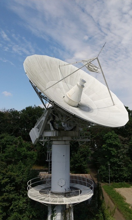
Koganei 11m VLBI station
| Diameter | 11m |
| Antenna type | Cassegrain |
| Mount | Az-El drive |
| Drive range | 5° to 90° elevation |
| -270° to 270° azimuth | |
| Drive speed | 3.0°/s elevation |
| 3.0°/s azimuth | |
| Completion | 1994 |
Participates in the regular geodetic VLBI observation of the International VLBI Project (IVS and AOV)
Otherwise used to receive data from NASA's solar observation satellite STEREO (joint with Space Environment Laboratory).
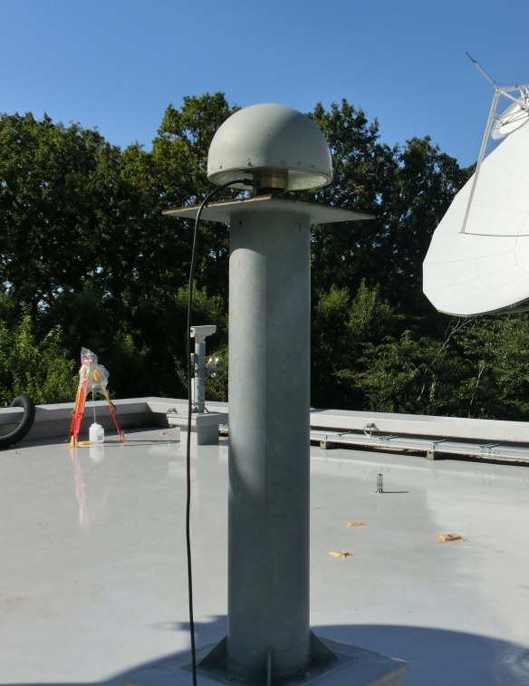
GNSS receiving station
| Reception bands | L1, L2 |
| Completion | 1994 |
Participating in the GNSS observation of the International GNSS Project (IGS)
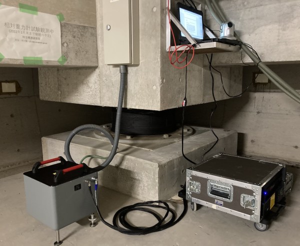
Relative gravimeter
| Model | Micro-g LaCoste gPhoneX |
| Performance | 1 μGal uncertainty |
| Noise | 0.45μGal/√Hz |
| Drift | <500 μGal/month |
| Installation | 2021 |
Measures variations in the local force of gravity close to NICT's optical clocks